Thursday, February 28, 2008

LEAP DAY STORM

MAINLY A WET LEAP DAY

Well Tara...Since no one could come up with a saying for what Snow means on your wedding day...I pulled some strings for you. I had the Snow Gods bring the Snow in Thurs Night and change it to RAIN during your Wedding!

Most of the snow that fell overnight was light and put down a coating to as much as an inch in spots. The snow is mostly over and we'll see rain as the day moves on.


TIMELINE
Storm will Start Thursday Night and bring snow through Friday morning then plain rain throughout the day Friday. Snow Accumulations are likely Thurs night at the start of the storm.

  • 10pm-12am Thurs: Snow Moves In
  • 10pm Thurs -7am Friday: Snow

Dusting to >1" Accumulation Near and South of Ohio River

1"+ Accumulation Up North Near Dayton

  • 7am-10am: Light Freezing Rain/Sleet
  • 10am-10pm: Plain Rain


TRACKING THE STORM


THE PENTHOUSE VIEW
View of Downtown from your Computer "Window"

Tuesday, February 26, 2008

BIG FRIDAY

I HEAR WEDDING BELLS...


Relax son...You Won't Be Alone On Friday!

There's an old saying that "Rain on your wedding day will bring you good luck". Personally, I think that is something a bride's mom told her to make here feel better as she had get wet walking into the church years ago. Nonetheless it makes everyone feel better that even the weather can't ruin a wedding.

Brock and Tara get hitched on Friday, so I ask the question if anyone knows of a saying if it SNOWS on your wedding day????


Don't Be Jealous Tara..Brock Likes His Women With Less Hair On Their Face!


THE NEXT SNOW

As we get the heating of the day on Wednesday, don't be surprised to see some on and off snow showers and some that are quite heavy. We will also be under lake effect bands off of Lake Michigan, but everything will not amount to much. Perhaps another dusting to 1/2"

Strangely...this winter, our largest snows have come from Clipper Systems. Much like the one you see here.

This storm is set to move in on Friday. We are going to be right on the border of SNOW/RAIN for this one. So we'll keep watching and will keep you updated!

Sunday, February 24, 2008

Could This Be A Repeat Of Last Week?

3:30pm UPDATE!

A Little Less Snow But A Little More Is On It's Way....

The storm is weakening and being torn apart by high winds and severe weather to the south.

We will see snow, but not as much as originally thought. There will be a break in the action late afternoon as the snow showers become scattered. Heavier snow arrives just after rush hour until near midnight. Total accumulations should still be only around 1".

Temperatures should remain above freezing until just before rush hour, so roads should be ok. Accumulations should only be on the grass and untreated surfaces.


We will be tracking the storm through Wednesday...so check back frequently for updates and be sure to REFRESH the page for the latest info!


TRACKING THE STORM


TIMELINE


  • 7pm-9pm Monday: Rain Moves In

  • 9pm Mon -11am Tues: Rain heavy at times

  • 11am Tues-6pm Tues: Snow Showers

Dusting (to 1" North of River) Accumulation by Evening Rush Hour but Temp at the surface should be above freezing until then. It should only stick to the grassy and untreated surfaces!


  • 6pm - 10pm: Snow continues
  • 10pm Tues - 1am Thurs: Scattered Snow Showers

1"+ Total Accumulation South Of River

1"-2" Along & North of Ohio River


We'll be tracking the storm all day Tuesday and making any necessary updates. Be sure to REFRESH the page when you return to get the latest!


THE PENTHOUSE VIEW
View of Downtown from your Computer "Window"


HEY MOM....WATCH OUT

The Severe Threat Is over for Central Florida...


Friday, February 22, 2008

A Little Break...BUT ONLY A LITTLE

Brief snow system moving through on Sunday morning and afternoon.

This quick moving system snows will primarly be for those counties along the Ohio River. Be sure to refresh to get the most up to date radar image. We can expect anywhere from a dusting to a half inch of new snow. The snow will mainly affect areas south of the Ohio River. In some extreme cases, we could see up to an inch. However, keep in mind that that is only in isolated areas.


Now the big question: Does this title above refer to last week or this week?

Be sure to check out "The Storm In Alvin's Head" for a great recap of the wild week we had last week. From Earthquakes, to Ice Storms, Snow to Eclipse...It was a week to remember.

This upcoming week seems to be active as well!

Best Snow chances this week:
  • Sunday : Light (1/2"-1")

  • Tuesday afternoon- Wed

  • Friday - Saturday.


Here is an EARLY LOOK how much we can expect for the ENTIRE WEEK. This is a good indication but will likely be modified some.


Stay close and REFRESH the page when you return to be sure you have the most recent update!


INTERACTIVE WEATHER


Take a look at the interactive weather forecaster. This will be on the page when there is a "lull" in the action for Cincinnati. There is a weekly forecast as well as hour by hour. SIMPLY MOUSE OVER YOUR AREA AND CHECK THE BOTTOM HALF FOR YOUR HOURLY FORECAST. I will be back with my forecasts and weather commentary when there is a threat for an accumulating snow or severe weather in the area.

Wednesday, February 20, 2008

HERE WE GO AGAIN... Storm 3 of 3 for this Week

UPDATE AS OF 3:00pm 2/22/08
"Creme Brulee" anyone? A classic quote from my wife as she tried to walk across our driveway this morning. I think that's about the best description that I've heard of what it was that you were walking on.

We are coming down the home stretch on this storm. We will see periods of freezing drizzle then snow showers late this afternoon. We will likely stay below freezing all day. We should switch back over to some snow showers near or just after rush hour and they should hang around overnight. Anything that does fall will be light.

  • Check out the updated Timeline & Artimis Cams on the right

FREEZING RAIN ADVISORY

Click here for details

YET AGAIN...
Cincinnati is in the path of another WINTER STORM. This is not an old post, this one is valid for Thursday 2/21/2008.

This storm will be different than the Tuesday Night Storm (2/19 to 2/20). This storm for Thursday afternoon and Friday morning will be more of what we've seen all winter. We will start as Snow and change over to Freezing rain, Sleet and then plain Rain.


TIMELINE
CHECK BACK FREQUENTLY FOR UPDATES AND REFRESH THE PAGE WHEN YOU RETURN


  • Near 2pm: Snow moves in

  • 2pm-5pm: Snow accumulates 1" (counties near and north of the area could see more than 1"-2"). SLEET AND FRZ RAIN BEGINS TO MIX IN

  • 5pm Thurs - 5pm Fri: Periods of Frz Rain will occur

1/4" to 1/2" ICE ACCUMULATION

  • Friday 5pm through Sat morning: Change back to Snow Showers


THE PENTHOUSE VIEW

View of Downtown from your Computer "Window"


THE GOOD...THE BAD...AND THE UGLY

UPDATE AS of 2PM

Snow Showers have redeveloped on the backside of this storm. Expect minor accumulations up to an inch through 4pm before they End.


IT'S AN INDUSTRY TERM

Quoting the Famous Mona Lisa Veto from my cousing Vinny...that one was "DEAD ON BALLS ACCURATE."

We picked up nearly 4" in Clermont County...3" here in Kenton County and 2.5" in Hamilton County. The heaviest snowband set up just along the Ohio River and to the East.

THE GOOD


THE BAD

Now, on to the "BAD" news. For those of you who thought this morning was a nightmare, round II is coming in Thursday evening. Timing will be the opposite as it appears the snow will start and be here for the Evening Rush Hour. It looks like it too will accumulate. We'll have more details as we fine tune the timing and amounts.

THE UGLY

The UGLY news is that it appears the Snow thursday afternoon will change to Freezing rain Thursday night. ICE ACCUMULATIONS are expected overnight Thursday into the morning Rush Hour on Friday. We'll have more on that in the coming posts.

LUNAR ECLIPSE

TONIGHT (WED) there will be a lunar eclipse between 10pm and 11pm. Be sure to watch for it as it may give you some clues for the upcoming storm.

Monday, February 18, 2008

WATCHING....MID & LATE WEEK

UPDATED 9:30pm 2/19/08


SNOW ADVISORY ISSUED


CLICK HERE TO READ


SURPRISE CLIPPER ...TRICKS ARE FOR KIDS


Be sure to check out "THE STORM IN ALVIN'S HEAD" at the bottom of the post to understand more about this type of storm.


This storm has hardly been mentioned yet I think this is one that catches a lot of people by surprise!


Tuesday Night into Wednesday looks to be more and more interesting around here. There will be a clipper system that moves out of Canada and brings us a COLD day. Somewhere "NEAR" the Ohio river (means 50 miles north to 50 miles south) a heavy band of snow will set up.

Here is our thinking on this. It will be all snow this go round:


  • Near 1AM: Snow Moves in

  • 3am-6am: Steady Snow

1"-2" Accumulation By Rush Hour


  • 6am-10am: Snow Continues

  • 10am-12pm: Tapers to flurries before ending

2"-4" Total Accumulation


THEN WE WATCH THURS NIGHT FOR A POTENTIAL WINTER STORM....


FINALLY A SNOWFALL MAP


When all is said and done, I think this Snowfall Map from Harris does a good job at giving us our total snowfall amounts from this storm. Everyone should pick up 2"-3" with this storm, and where that heavy band sets up as much as 4" can be expected.

CLICK THE MAP TO SEE A LARGER VIEW!


Is it snowing outside?


Friday, February 15, 2008

Is It Spring Yet?

RAIN...RAIN...GO AWAY

Our Sunday Snowstorm has turned into a rainstorm. The storm track this winter has been one that doesn't favor good snows here in Cincy. We either get a little snow and then rain, or rain and then a little snow. Just enough to tease you.


FOR THE WEEKEND

Saturday - We'll all see the sun and it will be in the 30's

Sunday - All the Race fans will be happy. You won't feel like you're missing anything if you sit by the TV and watch the Race. Get out your boat and make sure the sump is working. Rain will be around most of the day and will switch over to light snow sunday night. At this point, little if any accumulation

Monday - We'll have snow showers around like last wednesday. Though they may look impressive at times, they won't hang around long enough to amount to anything.

We'll keep an eye out for "The Next One"...after all the ICE storm we got this week didn't show up on the maps until just 3 days before it arrived!


INTERACTIVE WEATHER


Take a look at the interactive weather forecaster. This will be on the page when there is a "lull" in the action for Cincinnati. There is a weekly forecast as well as hour by hour. SIMPLY MOUSE OVER YOUR AREA AND CHECK THE BOTTOM HALF FOR YOUR HOURLY FORECAST. I will be back with my forecasts and weather commentary when there is a threat for an accumulating snow or severe weather in the area.

Wednesday, February 13, 2008

MORE TO COME

THE GREAT WHITE HYPE
Update 9:00am 2/14...UPDATES IN RED


One down and more to come. Famous last words I know. Before we move on to what could be an active next few days, be sure to check out "THE STORM IN ALVIN'S HEAD" section at the bottom of this post. He does a good job at recapping the storm and explaining what happend on the Monday Night Ice Storm. After all, this is Weather LOGIC!

On to the Hype... We've got 2 chances between now and monday to catch even more accumulating snow. The first will come on Friday and another Sunday Night. The Storm Sunday night looks to be the most impressive. The storm system for Friday looks very weak, and while we should see some rain and snow, it should not amount to much.

The storm looks to be a given and very strong. In fact, somone will get a blizzard out of it. There was a major shift in the track of our Sunday storm. In 1 days time, the computer models have brought the track from the east coast all the way through Cincy. While that sounds like we get the blizzard, those conditions will be on the Northwest side of the storm. Just look at the updated snowfall track here from Harris.

Note that this is 4 days out and we are only using this as guidance. More to come!


INTERACTIVE WEATHER


Take a look at the interactive weather forecaster. This will be on the page when there is a "lull" in the action for Cincinnati. There is a weekly forecast as well as hour by hour. SIMPLY MOUSE OVER YOUR AREA AND CHECK THE BOTTOM HALF FOR YOUR HOURLY FORECAST. I will be back with my forecasts and weather commentary when there is a threat for an accumulating snow or severe weather in the area.

Sunday, February 10, 2008

Finally...A Winter Storm For Us

WINTER STORM WARNING
Click for details.

UPDATE @ 10:15 am 2/12

So far the votes for less than 1" have the lead. Officially we received 1.8" of snow overnight with 1/3" of ICE. Admittedly, the sleet and freezing rain came in earlier than expected which put us on the lower of the forecast range for snowfall totals.

THE REST OF TODAY
The Winter Storm Warning will go on for most of the day, however we will switch over to Plain Rain near noon. However, don't let your guard down. Sleet and Snow will come back for the evening. We may pick up another 1" or so before it's all wrapped up.


HERE'S WATCHING YOU


As you can see, the ice is the dominant precipitation type this morning. We can expect another .25 inches of ice to accumulate through noon today.


TIMING IS EVERYTHING


UPDATED 10:30PM Monday Night 2/11


Snow should be heavy overnight. Where the sleet mixes in, it will keep the overall snowfall totoals down. We will see a change over to sleet and freezing rain, although a narrow band of heavy precip should set up near or just north of the Ohio river. Don't be suprised to hear some thunder as this happens. Thunder during a snow storm can produce 1 to 2 inches of snow in an hour.


Most everyone will see 2"-4" by morning except where that heavy band sets up. They get all the glory.


Alvin and I have put together a detailed timeline of how we see this storm unfolding. Take a look:


  • 5pm - 6pm: Snow will start to move in

  • 11pm - 3am: Periods of Heavy Snow Bands will move through

  • 3am-10am: Sleet, Snow and Freezing Rain. Heavy. Thunder Possible

2"-4" of Snow will accumulate by Rush Hour Tuesday. Up to 1" of Sleet will accompany the snow.


  • 10am-7pm: Sleet and Freezing Rain change to Rain

  • Some will melt as the rain moves in


Additional INCH of Snow & Sleet 1/4" ICE ACCUMULATION


  • 7pm-midnight: Snow showers


We'll be watching the storm and giving updates through Tuesday...as well as WATCHING WHAT COULD BE A REPEAT PERFROMANCE FOR THE WEEKEND!Check back frequently for updates and be sure to REFRESH the page when you return.


Saturday, February 9, 2008

Early Week Storm

WINTER STORM WATCH
Click for details.


A LITTLE WEATHER CONFUSION
As far as this winter goes...I think Mother Nature has been a little confused. We go from days in the teens, to days in the 60's. We go from a Snow tease to dodging Tornados. Is it still winter or are we going straight from fall to Spring? Well don't write winter off just yet...

"WELL, WELL, WELL...LOOKEY WHAT WE HAVE HERE"
I was searching around tonight to see if there would be any action for this upcoming week...and low and behold I found this!

Click to enlarge image...


This is a Harris Projected Total Snowfall Accumulation for the country through Tuesday Evening. According to this, parts of the Cincinnati area are in line for the largest snow of the season, coming in on Monday Night and into Tuesday. As of right now, I think this may actually be a bit on the low side. I think this MAY turn out to be an all snow event that would bring big time snows to cincy Monday night and into Tuesday . But...and it's a pretty big BUT...we are still a few days out and yet again...Cincinnati sits on the dividing line.

If this holds up and the models keep trending towards an all snow event, expect Winter Storm Watches to go up late Sunday.

We'll keep a watchful eye on it and have a county snowfall map up as we get closer to the event!

For now..enjoy the 3 degrees that is coming in for Monday morning!

Thursday, February 7, 2008

COLD WEEKEND COMING

GET THE COATS BACK OUT

The weekend storm looks to bring a mix of light rain and snow to the area. Accumulations, if any, will be very light. Most of the storm and the snow will be to our North.

We will be down in the single digits at night and only near 20 during the day on Sunday. The pattern is set up for just a few weak storms over the next few days. We're still waiting for the "Big One".


WATCHING THE RIVER

The Ohio River will be getting close to Flood stage later this weekend. Keep a watchful eye on it here. Click the image below to see the full view of the Ohio River Depth Forecast at downtown.


INTERACTIVE WEATHER


Take a look at the interactive weather forecaster. This will be on the page when there is a "lull" in the action for Cincinnati. There is a weekly forecast as well as hour by hour. SIMPLY MOUSE OVER YOUR AREA AND CHECK THE BOTTOM HALF FOR YOUR HOURLY FORECAST. I will be back with my forecasts and weather commentary when there is a threat for an accumulating snow or severe weather in the area.

Wednesday, February 6, 2008

Switch To Colder

SOUNDING THE ALARM
The worst of the weather has moved through. The Tornado sirens went off last night, but not because one was in the area. It is the National Weather Service standard to sound the alarm whenever a Severe Thunderstorm is in the area while we are under a Tornado Watch.


GET THE COATS BACK OUT
Expect Temperatures to drop on Wednesday. It will be colder this afternoon than our 57 degree morning. In fact, we should see flurries and snowshowers overnight. But accumulations will be light if any given how warm the ground is.

We are keeping an eye on Saturday as there may be a storm trying to work it's way in to bring a little more accumulating snow.


INTERACTIVE WEATHER


Take a look at the interactive weather forecaster. This will be on the page when there is a "lull" in the action for Cincinnati. There is a weekly forecast as well as hour by hour. SIMPLY MOUSE OVER YOUR AREA AND CHECK THE BOTTOM HALF FOR YOUR HOURLY FORECAST. I will be back with my forecasts and weather commentary when there is a threat for an accumulating snow or severe weather in the area.

Monday, February 4, 2008

SEVERE TUESDAY

TORNADO WATCH UNTIL 2AM


WATCH OUT
The Severe Storms should reach the area near Midnight. The storms out ahead of the cold front line are the ones that are tornadic and need to be watched closely.

The set up on Tuesday evening is for a line of storms to form back over Indiana south through KY & MO and push through the area as a vigorous cold front approaches. With Record Highs today and a chance for snowshowers on Wed afternoon...something has to give.

Watch the Storms roll in on the radar below or on the interactive Radar to the right where you are able to reposition it and zoom in to your own town.


Severe Weather is likely late Tuesday afternoon and overnight. This map should update live with Watches and Warnings as the day wears on. You are able to click on the image to zoom in as well as the key below.

The National Weather Service has put us under a Slight to Moderate Risk of Severe Weather on Tuesday.

The largest threat will be from frequent lighting and strong winds. The Tornado Threat is heaviest to our south, though it would not be out of the question with this set up to see isolated Tornados in our area. (Sorry Sheri)

SUPER SUNDAY AND SEVERE TUESDAY

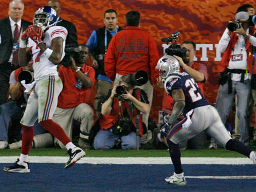
A GIANTS THRILLER!

For Once...I thought for once we'd let the pictures do the talking!


GIANTS 17 - PATRIOTS 14

Saturday, February 2, 2008

Waiting...

Next Up

Enjoy Monday, as Tuesday looks to be quite wet around here. We should be in the 60's, so the temperature will be nice. Flooding rains are possible and severe weather should be just to our south. We'll have the watch map and nataional radar up by Tuesday morning to make sure it stays that way.


INTERACTIVE WEATHER


Take a look at the interactive weather forecaster. This will be on the page when there is a "lull" in the action for Cincinnati. There is a weekly forecast as well as hour by hour. SIMPLY MOUSE OVER YOUR AREA AND CHECK THE BOTTOM HALF FOR YOUR HOURLY FORECAST. I will be back with my forecasts and weather commentary when there is a threat for an accumulating snow or severe weather in the area.

Friday, February 1, 2008

Storm Recap

CLEARING THE AIR

ok...I give us a "C" on that one. We had some wrong and some right. And depending how many updates you read on Thusday, we could have had a little more right than wrong!

Weather Logic is about making sense of it all, so i felt a good summary of this storm was in the cards.

I've made this a new post so that you can go back and see just how close we really were.

It's amazing to think that over a week ago, on the January 23rd, was the first post about this storm. While it wound up being one of the most significant storms this winter with Tornados in the South, Accumulating Snow to our West and our first Winter Storm Warning for the season here, it wasn't the Cripling storm for cincinnati we once thought it could be.

Now we only received some sleet and freezing rain overnight before it all switched back to Rain and melted...and although I think we had the timing right, I think we got "excited" over the Winter Storm Warning that was issued by the National Weather Service. I leaned more towards a significant ICE accumulation when that was issued. I think many expected an accumulating snow, but that was never in the forecast. We'll only put up Snowfall maps, that you've seen in the past, when we have a chance at a significant snow accumulation.

The storm is dying out as it pulls north and we will just see on and off flurries this afternoon up to a dusting.


"HEY...PUT THAT MUD DOWN TERLINDEN"

Now...the Best Part about having your own Blog is that you can do stuff like this!

The forecast from yesterday said sleet and freezing rain in the evening (left yesterday's post up below). Some claim it never happened....


No this is not deja-vu. This is a Thursday's Radar Loop..."Jeff...PINK = ICE". Granted it likely happened when you were sleeping, but a "tree also fell in the forrest last night". Someone heard it...did you?

NEXT UP

Not Much on the Horizon for the upcoming week. There will be some rain storms and warmer air, but no accumulating snow for a while. So we'll take it easy here for a while. I think we're 4 of 5 now. We'll take some of your fine donations and upgrade our equipment to get even more accurate. Hope to see you back soon.


INTERACTIVE WEATHER


Take a look at the interactive weather forecaster. This will be on the page when there is a "lull" in the action for Cincinnati. There is a weekly forecast as well as hour by hour. SIMPLY MOUSE OVER YOUR AREA AND CHECK THE BOTTOM HALF FOR YOUR HOURLY FORECAST. I will be back with my forecasts and weather commentary when there is a threat for an accumulating snow or severe weather in the area.