Saturday, December 29, 2007

Well...It's Something


SNOW ADVISORY- Until 10am Wed
Click here to read


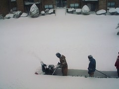
UPDATE ON THE STORM as of 8:30am Wed

It's hard to believe that 1 day after being in the low 50's we are going to have snow around on Tuesday with some minor accumlations and again into Wednesday.


This won't be a major winter storm by any means...in fact, the bulk of it went through Chicago on Monday but it will go into Canada and open the 'FLOOD GATES' for some COLD days and nights the remainder of the week.


  • Tuesday will be in the 20's, Windy and Snow around.

  • Tuesday Night, the snow will be more steady, expect additional 1"-2" with lows around 15.

  • Wednesday will be in low 20's with wind and snow around in the morning. Snow should taper off to flurries in the early afternoon. Low around 8 (no i did not forget another digit...That says EIGHT). An additinal 1"-2" are possible.

Total storm accumulations should be around 2"-4"with most of it blowing around, so it won't have an easy time getting an accurate measurement for any "Particulars" out there.


I SQUALL-U SQUALL- SNOW SQUALL

The snow should not be steady on Tuesday or Wednesday, but it will be impressive at times. Any one of these bursts of snow can quikly put down a dusting to 1/2 an inch at a time. So don't be shocked to see some accumulation around.


INTERACTIVE WEATHER


Take a look at the interactive weather forecaster. This will be on the page when there is a "lull" in the action for Cincinnati. There is a weekly forecast as well as hour by hour. SIMPLY MOUSE OVER YOUR AREA AND CHECK THE BOTTOM HALF FOR YOUR HOURLY FORECAST. I will be back with my forecasts and weather commentary when there is a threat for an accumulating snow or severe weather in the area.

Wednesday, December 19, 2007

Happy Holidays!


REMEMBER THIS?

Eventhough a White Christmas is not in the cards this year, we should have a pretty nice day weather-wise. Expect highs in the 40's during the day and 20's at night. Santa should have no problem getting through tonight as it will be in the mid 20s and frosty!

Since we are without snow this year, I thought I would put up a Photo from Christmas 2 years ago.

The weather seems to get really active towards the end of this week and heading into new years. There are a couple of Storms that may bring us accumulating snow. I'll keep you posted. Happy Holidays Everyone!


INTERACTIVE WEATHER


Take a look at the interactive weather forecaster. This will be on the page when there is a "lull" in the action for Cincinnati. There is a weekly forecast as well as hour by hour. SIMPLY MOUSE OVER YOUR AREA AND CHECK THE BOTTOM HALF FOR YOUR HOURLY FORECAST. I will be back with my forecasts and weather commentary when there is a threat for an accumulating snow or severe weather in the area.

A LITTLE ENTERTAINMENT

SNOWSLIDING --


Kids...Leave It To The Professionals (Crazies)

Monday, December 17, 2007

Waiting for the Next One...

INTERACTIVE WEATHER


Take a look at the interactive weather forecaster. This will be on the page when there is a "lull" in the action for Cincinnati. There is a weekly forecast as well as hour by hour. SIMPLY MOUSE OVER YOUR AREA AND CHECK THE BOTTOM HALF FOR YOUR HOURLY FORECAST. I will be back with my forecasts and weather commentary when there is a threat for an accumulating snow or severe weather in the area.

A LITTLE ENTERTAINMENT

SNOWSLIDING --


Kids...Leave It To The Professionals (Crazies)


There are 3 to 4 more storms coming over the next 3 weeks. One near Christmas...Some may bring accumulating snows. Be sure to check back for updates.

Sunday, December 16, 2007

Sunday Update

UPDATE 8:45am SUNDAY

- The Storm has shifted about 50 miles north overnight. This will bring the heaviest snow north of cincy to Dayton and points north. Snow showers will continue through noon...around an 1" accumulation is expected. I've taken the snowfall totals map down as I think most of us in cincy will deal with more wind problems than snow as the day wears on. You can still see it in the archived section.


A LITTLE ENTERTAINMENT

SNOWSLIDING --


Kids...Leave It To The Professionals (Crazies)


There are 3 to 4 more storms coming over the next 3 weeks. One near Christmas...Some may bring accumulating snows. Be sure to check back for updates.

Friday, December 14, 2007

"Thank You...May I Have Another"

UPDATED SUNDAY

-The storm will track to the north of cincy. We will be left with a few snow showers and strong winds.


WINTER STORM WARNING - (North & West of Cincy)
CLICK HERE TO READ


WINTER WEATHER ADVISORY - (South & East of Cincy)
CLICK HERE TO READ


Snowfall Totals through 12:00pm Sunday

THE MAP IS TOTAL SNOWFALL BEGINNING SAT NIGHT THROUGH SUNDAY LATE MORNING. This morning, expect areas to the South and East of Cincy may pick up an inch or so before the switch to Rain. Most everyone will pick up 2"-3" before the switch over.

It is important to note that the Worst part of this storm will be coming through Sat Night and into Sunday Morning. That is when everyone will pick up another accumulating snowfall. So find your house on the map and get the sled ready.


TIMELINE UPDATE

DON'T BE FOOLED. Think of Saturday as if nature is trying to catch you off guard. It seems many are falling into the trap. With the help of my partner in Dayton, Mr. Wayne Morris, we've put together a timeline for you. This is my our estimate as to what will happen this weekend...AN EXCLUSIVE WEATHER LOGIC TREAT---


SOUTH AND EAST OF CINCY:


  1. Between 8 and 10 am -- Snow moves in
  2. 11am - Midnight -- Rain
  3. 3am until Noon sunday -- Snow and heavy at times and VERY WINDY
  4. Noon Sunday until midnight -- Tapers to snow showers and blustery


NORTH AND WEST OF CINCY:


  1. Between 8 and 10 am -- Snow moves in
  2. Sleet and rain may mix in at times beginning around noon
  3. Mix of snow, some sleet and some freezing rain throughout most of the afternoon.
  4. Back to all snow after dark
  5. WINDY WITH SNOW THROUGH NOON SUNDAY


NOW COMES THE REAL FUN

The storm is slated to move through overnight Saturday. It is supposed to have pressure lower than most tropical storms. After Midnight Saturday, your windows are going to rattle the rain will start to sound more like golf balls hitting your roof and then it will go quiet...(with the exception of the wind rattling your windows). You will get out of bed to see what has happened and you will not be able to see your neighbor's house across the street b/c it will be snowing so hard. Perhaps even Thundersnow!


I'll be tracking the storm and keeping you updated should anything change.

Wednesday, December 12, 2007

The I-71 Divide

WINTER STORM WATCH
Click HERE to read


"Could Be Lunchmeat...Could be Peaches"
-Little Trivia: Can anyone name the movie this quote is from?


First, the winter storm that i mentioned as a possibility for Saturday is looking more likely. I think everyone in the Cincinnati area will see some measurable snow this weekend.

So...Where do you Live? There is a new poll out on the site today. Make sure you Vote. As this storm begins to take shape, it is looking more and more like someone ends up with 1/2 A FOOT and another person reading this gets a few inches with some rain and sleet mixed in for good measure.


So, as in many storms, this one looks to make Cincinnati its home for a 'plethora of gifts'. So vote on the poll located on the top right corner and that will help me know where everyone is located to fine tune this forecast.


EARLY THINKING

Let me start this section with "This is going to change". So many are looking for how much we are supposed to get out of this weekend's storm that I've decided to go ahead and give some rough estimates so everyone can understand the magnitude of this storm. I will have an updated Snowfall Forecast Map out on Friday.

  • Storm looks to arrive early Saturday morning

  • It will snow hard at times, especially in the evening

  • For everyone North and West of Cincinnati Metro - 4"-7" looks likely with some sleet at times. (Dayton looks to be all snow and 6"8"
  • Everyone South and East of Cincinnati - 2"-4" with some rain and sleet mixing in

WAIT...DID YOU JUST HEAR THAT?

THUNDERSNOW is possible with this storm on saturday. Should you get that phenomenon occur over your house, all bets are off as to how much snow you can get. It is not unheard of to see 2"4" an hour in a THUNDERSNOW event. So be watching. Everyone will not see this, but a select few may, especially just west of Cincy.


FLORIDA

Olga looks like it will die out over the Western Caribbean through this weekend, but I would expect all of you Floridians to be inside this weekend, but not due to the snow. Olga will be sending some rain your way. No Tropical Storm force winds or anything like that. Just be glad it's above 32 degrees with all that rain you are going to get.

Tuesday, December 11, 2007

WHITE WEEKEND....?

MAJOR WINTER STORM...P-O-S-S-I-B-L-E


Hey..Don't laugh at these guys...you may be doing this come Sunday!

Easy does it now...Get the paper bag if you need it and sit down for this one. Now when people see "Major Winter Storm" they get shortness of breath around here and immediately want to know how much and when. Well..before you run out to you local grocery store and fill up the car let's go over what we know to this point...
  • There will be a Major Winter Storm this weekend for someone.
  • It is still 3-4 days off and plenty of time to plan and most importantly for me to fine tune this forecast.
  • It will drop a large amount of snow in its path
  • AS OF RIGHT NOW, CINCINNATI IS IN THE PATH.

This is a "Texas Storm"...As many of you know, Cincinnati typically gets their big snows from the south. Now, i'm not crazy enough to put a snow total on a storm that hasn't formed yet, and is still 3 days away. This means a lot can happen, however there is a potential for this one to have enough snow to get out the Snowblowers you got for Christmas last year!


"EVERYONE...THIS IS OLGA"


Greetings Floridians. You have to love reading this stuff while you are down there in the low 80s. Well take it easy with all the laughter. Tropical Storm Olga has formed a few hundred miles to your south, and while a few models take the storm over Florida in the coming week, I do believe it will stay south of you in the caribbean. Enjoy your 80's...we'll send pictures!

I will have more information on the developing storm and just how much to expect coming soon!

Stay Close...and you better dig out that grocery card!


Friday, December 7, 2007

Between Storms

INTERACTIVE WEATHER


Take a look at the interactive weather forecaster. This will be on the page when there is a "lull" in the action for Cincinnati. There is a weekly forecast as well as hour by hour. SIMPLY MOUSE OVER YOUR AREA AND CHECK THE BOTTOM HALF FOR YOUR HOURLY FORECAST. I will be back with my forecasts and weather commentary when there is a threat for an accumulating snow or severe weather in the area.

WHEN THE GROCERY STORE IS JUST TOO EASY
We have also added a Koester's Corner at the bottom for all the Hunting and Fishing fans. For those who need more help against the wildlife than just a gun.

Thursday, December 6, 2007

Live Update Instrcutions?

AUTOMATIC UPDATES


There have been issues with the "LIVE" update notifications. It seems only 1 notification a day would go out per day regardless of how many times an update was posted...And while that's fine outside the ever changing world of weather, I have searched high and low to bring you a service that works.


Should you decide to get updates throughout the day. Please click on the new service to the right from FEEDWHIP. It is easy, free, and takes a only few steps:


  1. Enter keithscast.blogspot.com into the Webpage box on feedwhip

  2. Enter your email address on the left and click "Subscribe by email"

  3. Wait for 2 emails from Feedwhip. One will have your password and one will be a confirming email where you click the link to confirm what you set up.

  4. Log into your feedwhip account and ensure you are tracking Weather Logic under "Your Feeds"

  5. Finally click "Account Settings" to confirm what critera you would like to set for the updates (such as timing and content changes).

By all means, leave a comment if you have questions OR...you could always bookmark the site and refresh the page when you feel like it!


-The Weatherman

Round Two...Tonight


FREE SLUSHY FRIDAY?

Will it be another Rush Hour Mess?...Say it ain't so! This one's a little tricky. My wide range of tools want to bring rain into the Cincinnati area tonight, but I think that is going to be hard to do given how cold we are and the snow that's on the ground.


THE FORECAST

The drive home tonight should be fine. Snow, Sleet, and Freezing Rain should move in tonight after midnight and last through the morning Rush. I think Hamilton County and south into Northern Kentucky will see about 1" or less of a sloppy, slushy mess. I think as you head north into northern Warren and Butler county and near Dayton, you will see mainly snow and pick up another 2+".


Check back later this evening for an update as we may see the National Weather Service issue another Advisory.

Wednesday, December 5, 2007

NOT A BAD START

STORM UPDATE
Not a bad start to the blog or the winter with that 1st storm! Expect the snow to move out this evening with just a few flurries behind. Temperatures will drop into the mid 20's as rush hour approaches and we will be down around 18 tonight. So..COLD and ICY!

If you watched the storm on the radar, you would have seen just how close we came to getting nothing at all. In fact just 2 counties south of Cincy received nothing. 50 miles and I would have needed a Large Paper Bag for my head.

Feel free to comment or add pictures of your own. You can do so at the bottom of the page.

There is a bigger storm heading our way for the weekend. At this point, it will be mainly rain, however Friday mornign bares watching.

So...STAY CLOSE!

Tuesday, December 4, 2007

White and Wild Wednesday

Update as of Wednesday @ 10:15am EST


SNOW ADVISORY ISSUED By National Weather Service
click here to read


THE UPDATE


Snow will continue until early afternoon on Wednesday. The storm is still rotating through the area and we should all still expect to pick another up 1"-2" through early afternoon.

THE TOTALS


The map above are the expected Storm Totals. This should be what we are left with when this one moves out Wednesday evening. Everyone should pick up 1"-2" by morning, with an additional 1"-2"+ through lunch...2"-3" Total. Heavier totals the further north you get like 3"-5" in Dayton (Katie). So, find your house on the map (Sorry to the color blind!)


SNOW DAY?


Since this site had over 250 hits on it Tuesday, I thought I would add a special section for all of you who may need a quick hit for School Closings. You can click here for the latest closings, OR go to the Right Toolbar and find it under the Radar in a new section called "Helpful Links".


CHICAGO


Counting on 3"-5" total for you. In fact, you are included on the Map!


Who's Got it All?


So you now have:


  • A Radar - To watch the Snow arrive and leave

  • A Traffic Cam - To show what roads to avoid

  • School Closings - So you can call into work

  • Government Help - A direct Link to the NWS for their updates


Now you can sleep at night while everyone else runs around and panics!


The Fine Print: (Please note that all content in this blog is keith's opinion only and is subject to change at anytime w/o notice. Sole use of this blog for planning purposes, while obviously the best decision you can make, should be done at your own risk)

(With over 400 hits i sure hope i'm right)

Enjoy the Storm!

Monday, December 3, 2007

White Wednesday!

SNOW'S COMING... UPDATE

NEXT UPDATE COMING OUT SOON!!!


SNOW ADVISORY ISSUED By National Weather Service
click here to read


Yes, It's going to Snow and this time Cincinnati and Chicago will both get in on it.

I would expect the National Weather Service to issue a Winter Weather Advisory for Cincinnati sometime on Tuesday.


The Snow is expected to start in Cincinnati Tuesday evening and last until Wednesday. Heaviest snow will fall Tuesday night and into Wednesday, so you will have a fun drive in on Wednesday.


This is not a massive storm by any means. Usually Cincinnati will get big snows from storms that come out of Texas, this one is coming from Canada. I think most of us will see 1"-2" or so on the ground by Wednesday morning and finish up with around 2"-4" (more to the North). The biggest problem with this storm is the timing with Rush Hour.


Be sure to check back in case there are may be updates. The storm has yet to form.


FOR ALL THE NEW FOLKS

There are a number of new people on the page today. The site is still under a week old. But check out the older posts so you can see how it all works. They will always be archived over on the bottom right as well:

http://keithscast.blogspot.com/2007/11/snows-comin.html

http://keithscast.blogspot.com/2007/11/storms-coming.html

Don't Cut Me Off!

New stuff added to the site. I have added Traffic Cams that load live when you refresh the page when the page is pulled up. They are located to the right and show a popular I-275 and I-71 Exits. Watch for backed up traffic, or the road conditions of the storm moving in.

Chicago

You will likely see 4"-5" and begin around lunch on Tuesday.

Wednesday, November 28, 2007

WELCOME

First Things First...
I'm proud to say it's come to this. My own Weather Blog. Many of you are here b/c we have likely crossed paths at one point and know of my passion for the weather. You've asked for a forecast from me or you've been made aware of my shameless approach to forecasting the weather and someone sent you.

Last year I sent out hundreds of individual emails each time a flake of snow was in the forecast. Seems Cincinnati folks get a little restless when solid falls from the sky. Well No More...

WELCOME TO WEATHER LOGIC...The Home of Keith's Cast...where we will give more than a forecast..but rather explain what's going on...you know...it's weather that makes sense!

HOW IT WORKS

Across the top of the page are links to our other related sites. We have a Tropical Weather section during the summer which becomes our Winter Storms page during the winter. There you can find more detailed information on those specific storms. Koesters Corner is dedicated to our Fishing and Hunting friends...All content has been built at the request of Michael Koesters...but if you see something you want...we'll go get it. Finally, a link to the National Weather Service...so you can see their official forecast.

The main page is organized out into sections...Typically, "What's Coming" will be at the top and will share our daily thoughts of weather systems affecting the area. We'll typically update the site by 9:30am during the week and take the weekends off...but post more frequently and over the weekend if severe or winter weather is imminent. If that occurs, we'll post all WATCHES/WARNING from the National Weather Service at the top as they are issued.

"RADAR" will always be a live feed and is clickable to zoom in.

"INTERACTIVE WEATHER FORECASTER" has numerous 5 day forecasts on it and the bottom section defaults to hourly forecast for Cincinnati. You can get more information by hovering over a different city, or changing the bottom default to radar or something else.

"PENTHOUSE VIEW" is a live view from a local news station's tower cam near Downtown Cincinnati.


Now Look Right

The right side of the page is the toolbar. Complete with daily weather photos, an Interactive Radar that is zoomed in close to cincy, can be clicked on, panned, zoomed in or out to anywhere in the country. There are also Traffic Cams to see road conditions and traffic issues developing, Helpful Links complete with weather models, earthquake monitoring and school closings! Archive section for any past posts, a site hit counter, and polls or whatever else we think may be of interest from time to time.

Finally...U2
Feel free to leave behind comments...on any section. Hopefully we save you some time and headaches by knowing what's coming, areas to avoid, and help you plan for that all important flight out or sled ride. So enjoy and keep it close...the weather is ALWAYS changin'.