Monday, November 14, 2016

What's Coming


5 Day Snowfall Accumulation Forecast
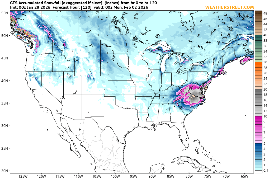
The map below forecasts total snowfall accumulation over the next 5 days. You want to watch for the placement of the colors after each update and see if they make it into the Tri-State

It will update twice a day after each forecast model run...generally by 1am and 1pm.


THIS SHOULD ONLY BE USED AS GUIDANCE AND NOT AN INDICATION TO RUN TO KROGER!!!

Friday, January 21, 2011

Thursday, December 16, 2010

WHAT'S COMING...1/20/11

WINTER STORM WARNING

Thurs Morning Update:

The snow has moved in and the models have backed off with the snowfall totals, however, I think this may be a case of where they are wrong.

Watching the radar this morning I see some heavy banding setting up and I think the 'heating of the day' adds to the instability.

I expect the intensity to pick up as we head towards lunch and then start to lighten up around the rush hour. The heaviest snows should be from 11am to 4pm today. I am going to stick with my 5" call at this point. Besides...it will be so windy and the snow will be blown all around by the time we can get a measurement...We'll always have that to fall back on! ;-)

Be careful out there this afternoon...and I'd get a few layers ready for tomorrow...it will be lucky to get into the Teens!

-----------------------------------------------------------------------------------

It's mid-week and DO YOU KNOW WHERE YOUR SHOVEL IS? Time to put the umbrella away and dig out the shovel and salt....you're gunna need it by Thursday night.

Yes folks, a Winter Storm Warning is up for the Cincinnati Area, and we agree this one will be a "shoveler". Click HERE for the details.

This is going to be a 24 hour storm and primarily through the daylight hours on Thursday. So if the schools don't cancel Thursday morning, you may be looking at an early release. We think this one gets going just before the morning rush on Thursday and finishes just after midnight.

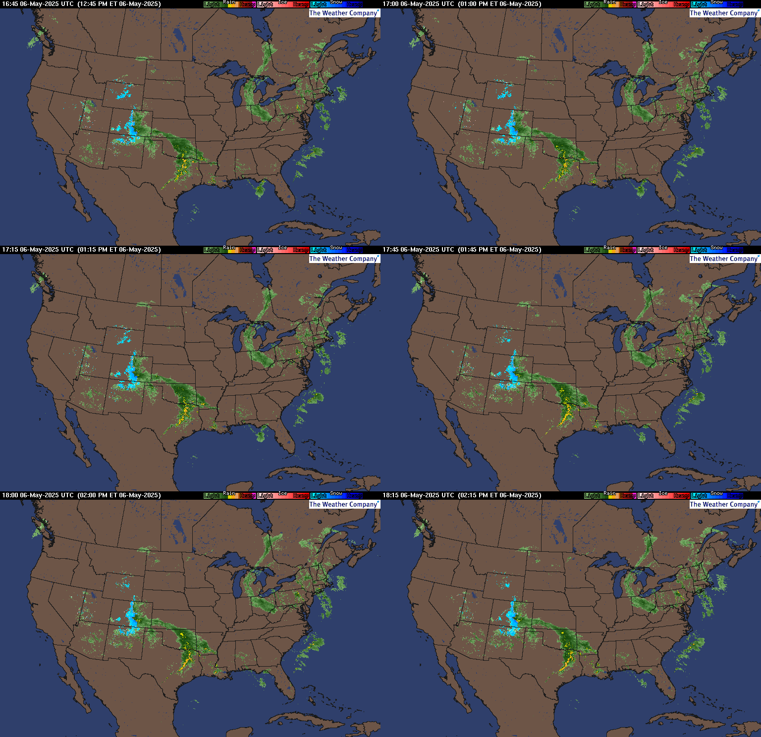
A storm will come out of Wyoming and Nebraska on Wednesday (watch the radar below) and it will track across Missouri and right into the Ohio Valley for Thursday. Snow should start just before the morning rush hour and pick up in intensity as we head towards lunch on Thursday. It will continue into the evening and should begin to taper off around the evening rush hour.

All said and done, we think right around 5" is a good call on this one. And this won't be one of those "South of the river gets this and north gets that"...this one is set up to get everyone in on the action!

We'll be watching the noon model runs and will let you know of any changes...but for now, I'd locate that shovel!

Here's how we see the accumulations going on Thursday:


Wednesday, October 27, 2010

Severe Weather Outlook

Today's Severe Weather Outlook
Below is a live feed from Intellicast of the Severe Weather Outlook for today.  These maps are generated from the National Storm Prediction Center and are updated 5x a day.  That feed will automatically update the map you see here.

They can be a bit confusing with the definitions they give, so we've provided some that are a bit more 'logical'!!!

GENERAL - Typical Thunderstorms
SLIGHT - Actually Means Severe Weather Likely
MODERATE - Duck and Cover
HIGH RISK - Leave!!!


Tuesday, January 5, 2010

Watches/Warnings


4"-5"...1/7 Update

IT'S HEEERRREEEE...

AFTERNOON UPDATE: No big changes to update everyone on. The storm is performing as expected. The 'Wildcard' was played and the Bursts of heavy snow have been fun to watch.
Snow will wind down and the winds will pick up this evening. Another inch is possible as we head from Thurs night through Friday...but the next story is the Wind and COLD coming.

We think the storm will continue to bring snow through most of the afternoon with heavier bursts from time to time before tapering down by the evening rush.
-------------------------------------------------------------------------------------

There are 3 things to watch today...

  1. The Heavy Burst of snow late morning/early afternoon due to the Wildcard (read below)
  2. The Dryslot coming very close to the area
  3. The winds picking up tonight

These three things will determine exactly how much you receive in your backyard. Now, don't forget, this is going to be primarily a daytime event. Not sure why the schools went on a delay as things will go downhill quickly as we head through the morning.

We still like the call of 3"-5" across the area. With the heaviest being on the North and West side of the city and the lower amounts on the East. Check out our snowfall map below.

After reviewing the forecast models, there is 1 new development. A "Wildcard" if you will. The storm will cause Divergence (splitting of winds high in the atmosphere) over the area around and just after lunch. This will cause the air over the area to rise quickly and enhance the snowfall for a few hours. Where that happens isolated snowfall amounts could be a bit higher in those locations.

Click the image below to see what it looks like...or you could just take our word for it.


We'll be monitoring the storm through the day, and let you know of any changes or updates.

KEEP IT CLOSE!

TIMELINE:
  • 7am-9am Thurs: Snow Begins

  • 9am-4pm Thurs: Snow...Increasing In Intensity

  • 4pm-Fri: Snow Showers

2"-3" Accumulation by 6pm...additional 1"-2" through Friday.

(CLICK IMAGE TO ENLARGE)


Total Accumulations 3"-5"

Sunday, March 8, 2009

Monday, February 2, 2009

INTERACTIVE FORECASTER


Take a look at the interactive weather forecaster. There is a weekly forecast as well as hour by hour and radar. Simply select which details you want from the drop down menu and mouse over your city for the details.

PENTHOUSE VIEW

For those of you "Cube-locked"...Take a look out "Our Window" and watch the storm LIVE.

Wednesday, January 28, 2009

Our Thoughts...BURST

TUESDAY 4:30PM UPDATE
The Burst has centered itself right over Hamilton county and is stationary. Hamilton, Butler, Warren, and counties east along the river in Ohio and Kentucky will be under the "burst" of this storm and will pick up near 6" of snow before all is said and done. The situation is isolated and if you are outside of the burst we still expect most areas to get 2"-3" of snow.

So we are going a bit higher than most with snowfall totals. I've heard everything from a dusting to 1" with isolated 2". We think this will be a bit more dramatic than that.

Interactive 7 Day Forecaster


Take a look at the interactive weather forecaster. There is a weekly forecast as well as hour by hour and radar. Refresh the page if forecaster is missing.

Sunday, January 25, 2009

The Latest Jan Hit

11:00am Update...

Our winter storm warning has expired. Snow should begin to wind down as we cross noon and the storm pulls away. Power outages are rising quickly and we are now over 53,000. (What was your vote...?)

We expect only snow showers as we head through the afternoon with no further accumulation. We may even see a peak of sun later in the day. For now..try and dig out and warm up if you have power because the models show another Winter storm on the way in a few days....More on that Thursday.

Power Outages

TUESDAY

  • 1pm: 16
  • 2pm: 97
  • 11pm:367

Wednesday

  • 6:45am: 9,232
  • 7:25am: 18,723
  • 10:10am: 29,992
  • 11:30 am: 53,404

WINNER...for the few that picked the OVER. Now all we need is some door prizes to give away...Bummer Bad Economy got us again!

Look for a recap of this storm and an explanation as to why it was so bad in the coming days under "The Storm in Alvin's Head". You can get there by clicking at the link at the top of the page or the hyper link here. For now, site instructions and update information is on there for anyone who had any trouble finding their way around over the last 2 days.

What's Coming...Jan Hit

A BREAK
As the snow moves out...we'll see a break until Thursday evening as a clipper is expect to roll through. More on that a bit later.

Our Thoughts Jan Hit

UPDATE: 11:00am Tuesday


STORM 1 TIMELINE : COMPLETE


Monday 11pm-Tuesday 1am: Snow Begins may mix with a litte sleet at onset
1am-7am: Snow, heavy at times (3"-4" Accumulation)
7am-10am: Snow Showers (1"-2" additional Accumulation)

Accumulations of 4"-6" with Heaviest amounts along and south of the Ohio River by noon Tuesday.
----------------------------------------------------------------------------------------
STORM 2 TIMELINE

Tuesday 10am-12pm: well needed break
12pm - 4pm: light mix (1"-2" sleet/snow & light Ice Accumulation)
4pm - 4am: Sleet/Frzing Rain (Heavy) (Up to 1" Ice Accumulation)
Wednesday 4am - 7am: Sleet gets added back in (1" Sleet..1/10" Ice)
7am-12pm: Snow (3"-4" Accumulation) Most NW side of town
12pm -5pm: Flurries and snow showers and finally a break. (no additional accumulation)

Storm 2 Accumulation 4"-5" Snow/Sleet (3/4" Ice Accumulations ) by Wednesday noon.
---------------------------------------------------------------------------------------
TOTAL STORM ACCUMULATIONS WILL VARY DEPENDING ON SLEET AND FREEZING RAIN, but should be in the 8"-12" range with additional Sleet and Freezing rain accumulation.

At this point...does it really matter if it's 5",6",7",8",9",10",11", 12"....? We've got our best winter storm on the way this season.

Interactive 7 Day Forecaster


Take a look at the interactive weather forecaster. There is a weekly forecast as well as hour by hour and radar. Refresh the page if forecaster is missing.

Saturday, January 24, 2009

BACK TO REALITY

CHANGES ARE COMING

The 50's from Friday are now gone and we are back in the 20s this weekend. Morning flurries and snow showers on Saturday won't amount to much, but it does indicate that the cold front has gone through and is now south of us.

Next Week is still looking active. The cold front that goes through this weekend is going to stall near the KY/TN border. A large storm will hang back in the 4 corners and kick out smaller storms towards to Ohio Valley beginning on Sunday night. Accumulating snow looks likely on Tuesday, and then a stronger storm needs to be watched for Thursday. The stalled front will be the track for the storms. Since we are projected to be on the north side of the front on Tuesday, our precip should remain all frozen. Thursday's storm will be stronger and may be a different story as it pushes warmer air into the region.

Take a look at this computer model image for Tuesday. Given how narrow this band there will be a sharp cutoff to the accumulating snow. We'll likely see another situation where if you live just 5 miles outside of area effected by the track of this storm, you see nothing.

At this point, don't focus on the exact placement of the storm, that will be modified and worked out over the weekend.


AND THE WEATHER ISN'T THE ONLY THING CHANGING....


BIG CHANGES...FOR WEATHER LOGIC
A NEW AND IMPROVED WEATHER LOGIC IS COMING!!!! We are close to completing the new site and expect to have it up and running for the action next week. Here's a sneak peak. We expect to have the new site up by the end of the weekend...


WEATHER FORECASTER


Take a look at the interactive weather forecaster. There is a weekly forecast as well as hour by hour and radar. Enjoy.

Monday, January 19, 2009

WARM UP & SNEAK PEAK

FRYIN' FRIDAY
50's today people....50's! The Nice warming trend we've been talking about is here and you should enjoy it today, because it will literally be gone tomorrow. We'll have highs near 30 this weekend with some passing flurries off of the Great Lakes.

Next Week is still looking active. The cold front that goes through this weekend is going to stall near the KY/TN border. A large storm will hang back in the 4 corners and kick out smaller storms towards to Ohio Valley beginning on Tuesday and continuing until the weekend. The stalled front will be the track for the storms. Since we are projected to be on the north side of the front, our precip should be frozen.

Although these will be weaker storms, they will have the potential to drop accumulating snow in a narrow band, that right now looks to be focused on our area. Given how narrow this band there will be a sharp cutoff to the accumulating snow. We'll likely see another situation where if you live just 5 miles outside of area effected by the track of this storm, you see nothing.

At this point, don't focus on the exact placement of the storm, that will be modified and worked out over the weekend.

For now, enjoy the warm up...and check back for updates next week's storm.


BIG CHANGES...FOR WEATHER LOGIC
A NEW AND IMPROVED WEATHER LOGIC IS COMING!!!! We're going to use this downtime to improve the Weather Logic site. With all of our funding, we've gone out and purchased a new free template that should enhance the site and content, complete with links and tabs to more easily navigate. Here's a sneak peak. We expect to have the new site up by the end of the weekend....and ready for next week.


WEATHER FORECASTER


Take a look at the interactive weather forecaster. There is a weekly forecast as well as hour by hour and radar. Enjoy.